The Ministry of Defence (MOD) has published a Tender Notice for Project Wayfind, valued at up to £10 million and slated to run for two months.
According to the notice, issued on 17 February 2025 via Find a Tender, the project aims to “focus on the importance of using alternative sources of position, navigation & time, alongside GNSS” to counter the rising threat of Global Navigation Satellite System (GNSS) denial and degradation.
Quoting the official documentation, the MOD observes that “fusing different PNT sensors is not a new concept, but this contract will focus on being able to robustly test the performance of fusion engines, as well as adopting a common data standard for them, whilst seeking to also leverage performance improvements from strongly performing alternative PNT sensors.”
These efforts will be overseen by the Space Delivery Team (Space DT), which owns the project, and is seeking a preferred supplier to “develop and prove the performance of at least 2 multi-PNT-sensor fusion engines within at least 4 x 3-month spirals.”
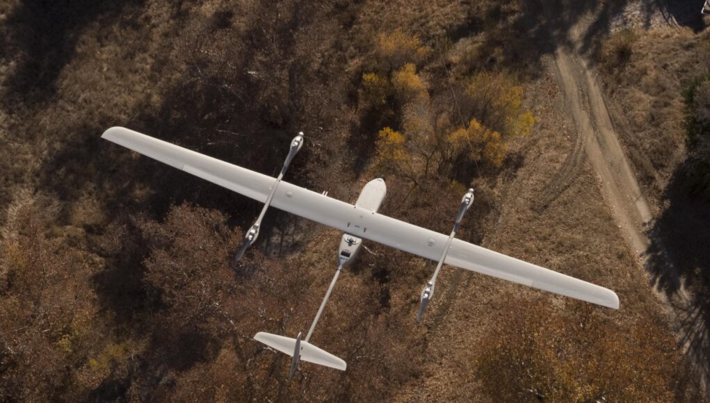
A key goal of Project Wayfind is “improving Uncrewed Aerial Vehicle (UAV) operation within environments where the Global Navigation Satellite System (GNSS) is degraded and/or denied.” The successful supplier will be expected to:
“Quickly identify existing, potentially suitable PNT sensor fusion products and alternative PNT sensors.”
“Collate and communicate detail surrounding their performance and availability.”
“Organise, facilitate, and regularly repeat trials that can provide robust evidence of how the PNT sensor fusion products and individual sensors perform in a GNSS denied and degraded environment.”
“Lead on fast-paced improvements to those PNT sensor fusion products, with the aim of providing fieldable technology through spiral development in approximately 3-month increments.”
In addition, the notice highlights that “a key focus for Space DT is on a PNT sensor fusion product that can quickly and easily operate on a range of UAVs in a variety of different environments, with different PNT sensors, i.e. using a common data standard such as All Source Position and Navigation (ASPN).”
Space DT plans to award “a short-term contract (6-weeks) to an estimated 5 suppliers,” after which the MOD will “down select to 1 or more suppliers to enter into a full-term contract (between approximately 1-2 years).” The total value for these short-term contracts is “intended to be approximately £1Million,” to be divided among the selected suppliers, while the full-term contract may reach “approximately £9Million.”
Documentation clarifies that the short-term contract will be carried out primarily at the OFFICIAL security classification level, but “with an option to use higher classification of information, if the preferred supplier is able to operate at that level.” The MOD further notes: “The supplier must ensure they are registered prior to Contract Award,” and will use a specific e-procurement system for managing invoices.
The tender remains open for applications, and the deadline is set for 21 February 2025 at 11:59. As stated in the notice, “A full description of the Cyber Risk levels is available at DEFSTAN 05-138,” indicating potential providers should be aware of relevant cyber requirements.
At the UK Defence Journal, we aim to deliver accurate and timely news on defence matters. We rely on the support of readers like you to maintain our independence and high-quality journalism. Please consider making a one-off donation to help us continue our work. Click here to donate. Thank you for your support!











Off topic: if anyone is intetsted there’s a livestream from John Healey addressing the Institute for government at the moment: …youtube.com/watch?v=6jf_z8n2u7o
It is on BBC news as well. And for once, I have the pleasure to be in your country, visiting london on a sunny day 🙂
Bienvenue à Londres
You have my deepest sympathy’s.
No I will not join the punctuation police and issue a warning there.
I agree as long as what you have written is understood. Punctuations are used for oral reading to help with breathing using comma full stop plus Question marks exclamation marks to emphasise the sentence in question. No doubt they will have a go at me now but all spelling must be correct.
Let’s not forget that all inventors were not letter perfect and had dyslexia or on the verge of some mental problem. They can problem solved because they think laterally and think why can’t it be done instead of no it can’t be done
Fascinated to gain some further insight into what proposals will come out of this. Ukraine is now utilising optical cable in their drones to get around this problem but that clearly adds complexity and limitations to drone use. Anyone with deeper knowledge able to speculate?
On a separate note I will equally be interested to hear about the prospective NGAD decision (or is it just another one for the road). If Musk’s desire for only drone based systems of whatever complexity takes a predominant role, the question certainly needs to be raised as to if and how they can solve similar control and targeting problems, but on a larger scale. As Teslas have the worst reliability and safety record on US roads a recent report claims, one has to ask does that bode badly for his ideas on military drones or does the attitude prevail that in a one-way weapon it doesn’t really matter if it crashes regularly and hey you can learn from it can’t you; I guess it depends if you are under the flight path mind. Anyway I would be amazed if a manned aircraft were not at the core of the programme, though pure Air Superiority, as would be the case in a natural F-22 replacement, will not be its primary design focus I suspect reflecting more of the Tempest thinking focused on a multi role capability to operate with and supplement B-21 in both defence and attack role. Probably the plane that if not for the VSTOL factor the F-35 would have close to being.
Navigation with out Sat Navs
Why not design an up to date sextant with all the programming you need of the sun’s positioning all latitudes and longitudes at certain times of the day,where on the compass they are>
You would also need a scale to compensate for the height above ground level if a object using the apparatus was in flight. To take a reading a lense would take a snap of the sun and if all longitudes and latitudes of the world were correct your position would hopefully be down loaded with the heading you need to progress on with further positioning checked and further headings checked to attack targets position. You would nod the longitude and latitude of the target down to minutes and seconds for more accurate targeting
In the night could a reading of the moons position give you a reading of where you are or fixed point in the stern system viewed in the hemisphere you are in.
This is an amazing idea. You k.ow, they used to believe that migrating birds used some kind of magnetising ions in their beaks to navigate using the geometric true north field of Earth, but have more recently found that actually they ‘compute’ the light, which is truly remarkable, and suggests such a realm of navigation does exist.
I don’t fully.understand the brief, how do Gwen towers work in the US? What about RF signals, a mesh network? We already have the infrastructure with street lamps.and traffic lights, much cabling in rural areas etc.