

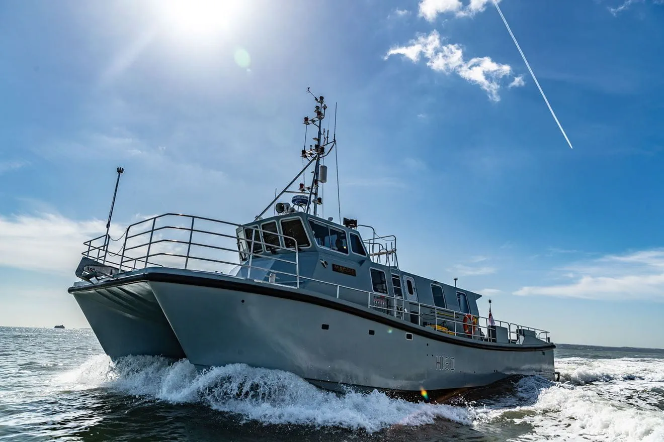
Royal Navy survey vessel HMS Magpie has completed three months of work mapping the Thames seabed around London Gateway and other locations, gathering data intended to support shipping, underwater infrastructure security and military operations.
The Royal Navy said the 18-metre survey craft collected detailed information on the depth, topography and composition of the riverbed, including waters surrounding London Gateway, which it described as the UK’s second-largest container port.
According to the service, the survey will provide a detailed picture of the seabed and identify changes caused either by natural processes or potential interference by unknown actors. The resulting information is intended to help keep commercial shipping routes open, support the protection of underwater infrastructure and provide data which could be used during future military operations in the estuary.
Lieutenant Daisy Nelson, Commanding Officer of HMS Magpie, said: “By providing this picture of the maritime environment Magpie has built the foundations necessary to ensure the River Thames and the strategic ports therein, are able to remain safe and open to all users of this critical waterway in time of conflict.”
She added: “It is this enduring work that Magpie conducts – alongside her sister vessels in the Royal Navy’s Hydrographic Exploitation Group – which assure both freedom of navigation and understanding of the underwater battlespace, now and into the future.”
London Gateway opened a little over a decade ago near Canvey Island and handled a record three million containers last year, according to the Royal Navy. The service said approximately one third of the UK’s containerised imports and exports pass through the port.
HMS Magpie is operated by a small team of specialist Royal Navy hydrographers and is primarily used to gather highly accurate bathymetric data in coastal and inshore waters. Despite displacing only 37 tonnes, the Devonport-based vessel carries a suite of survey equipment including multibeam and single-beam echo sounders and side-scan sonar.
Its multibeam echo sounder can transmit more than 500 individual sound pulses into the water column simultaneously, up to 400 times each second. During the Thames work, individual transmissions could collect data across an area up to 65 metres wide, depending on water depth. The Royal Navy said the vessel can survey up to 270 square metres of seabed per second, an area roughly equivalent to a Wembley football pitch every 30 seconds.
Over the three-month operation, Magpie recorded sections of the Thames riverbed to centimetre-level accuracy. The data has since been passed to specialists at the UK Hydrographic Office in Taunton for analysis and use in navigation products. The vessel also surveyed the waters surrounding HMS President, the Royal Navy Reserve establishment at St Katharine Docks near Tower Bridge.
The area is exposed to strong tidal conditions, with the Navy estimating that spring tides can move as much as 30 million tonnes of water past the jetties during a single tidal cycle, altering the shape of the surrounding riverbed. Magpie‘s crew produced a three-dimensional survey of the underwater infrastructure surrounding HMS President within several hours. The information will be used in work concerning the long-term maintenance of the Navy’s London base.
The ship’s equipment also includes a single-beam echo sounder capable of examining the seabed substrate and a side-scan sonar used to produce detailed imagery of seabed objects and features. Following completion of the Thames work, HMS Magpie moved to survey areas off Britain’s east coast, including military wreck sites on behalf of the Salvage and Marine Operations organisation.
Those tasks include surveying the wreck of the light cruiser HMS Arethusa, which sank off Harwich after striking a mine in 1916.




How many trolleys? Lol