
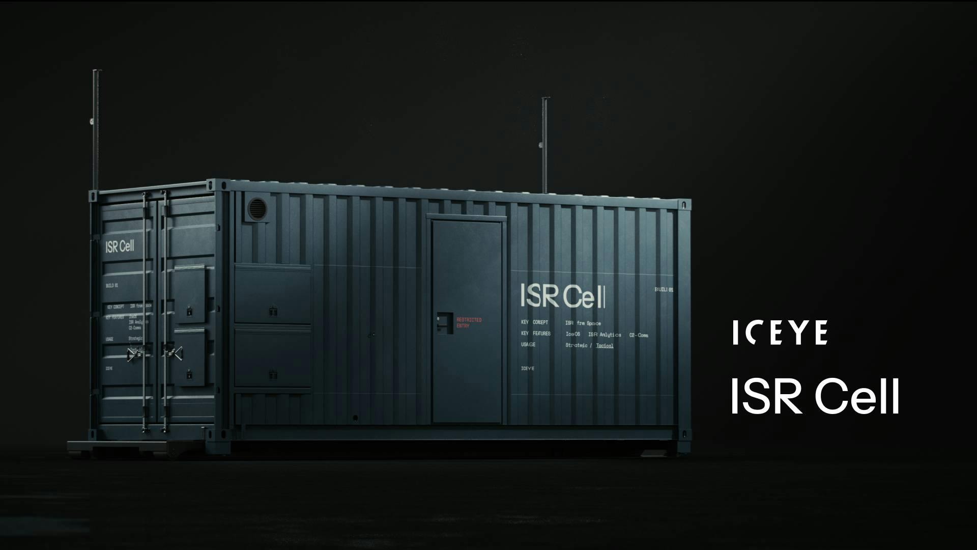
ICEYE has unveiled a 20-foot, military-grade “ISR Cell” that lets units at the edge task SAR satellites, downlink imagery and run AI analytics on site, compressing the space-ISR loop from hours to minutes.
The containerised unit, shown at DSEI, has been proven in NATO exercises, with first customer deliveries planned for early 2026, the company says.
The Finnish firm, which operates the world’s largest commercial SAR constellation, is pitching the Cell as a way to move satellite intelligence from centralised headquarters out to brigade and division level and high-risk locations, with an optional mobile ground station for independent downlink if fixed infrastructure is degraded.
“It puts strategic-grade space intelligence tools in the hands of the commander in minutes, not hours or days,” said ICEYE co-founder and CSO Pekka Laurila. “This foundational capability… enables faster and more reliable ISR loops across the force at scale.”
What is inside the box
ICEYE’s Dr. Shay Strong, VP for Analytics, walked media through the system:
- A 20-foot container hardened for forward environments with life support and power interfaces
- Four operator workstations mapped to distinct roles: team lead and mission command link, satellite tasking lead, imagery analyst running AI and ATR, and reporting and dissemination
- Integrated tasking, downlink, processing and exploitation software tied to ICEYE’s ground segment
- Optional bolt-on mobile ground station for sovereign, on-site downlink. Otherwise, the Cell uses ICEYE’s global Connect network over secure links into C2 and C4 systems
Units can generate collection requests, task sovereign or ICEYE-operated SAR satellites, ingest data locally, run automatic target recognition and classification, then push tailored geospatial products into command systems without waiting on a distant headquarters. Strong acknowledged one hard problem still being worked with early users: deconfliction and prioritisation when multiple echelons want to task the same assets at once.
SAR’s all-weather, day-night sensing is central to the pitch. ICEYE says it has launched 54 satellites since 2018, with more than 20 additional launches planned this year and again next. The constellation provides daily revisit or better and can collect at up to 0.25-metre resolution. Satellites use ion propulsion for orbit insertion and maintenance, while beam steering and multi-angle collection enable material cues and motion detection beyond simple amplitude imagery.
Strong’s team builds the in-box analytics. AI models cut the cognitive load for non-specialist tactical users. The aim is to move SAR from niche product to routine cueing and confirmation tool in the kill chain. “We want operators to get decisions fast without needing 30 years of SAR expertise,” she said.
The Cell is designed to deploy by truck, ship or airlift and operate wherever units can provide power and comms. ICEYE stresses it can serve as a contingency ground segment if fixed sites are jammed, damaged or saturated. The firm also noted this complements, not replaces, airborne ISR. Drones and aircraft are real-time but range and EW limited. Space assets are global and less vulnerable to local jamming.


