Airbus has said that a test flight of its solar-powered Zephyr unmanned aircraft was “interrupted” due to adverse weather conditions last month.
The flight on March 15th was “interrupted earlier than planned due to adverse weather conditions”, an Airbus spokesperson said. “We are working hard on preparing for the next trial”.
Whilst Airbus refused to admit the aircraft had crashed, Airservices Australia, the country’s air navigation service provider, confirmed it had crashed, adding no one was hurt in the incident.
The crash occurred near the remote town of Wyndham, 1,200 miles north east of Perth. Airbus began using the area last December because of its “largely unrestricted airspace and reliable weather”.
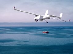
The drone, originally developed by QinetiQ, is designed to operate at an altitude of around 70,000 feet (21 kilometres) for months at a time to conduct Intelligence, Surveillance & Reconnaissance (ISR). The program was sold to Airbus Defence and Space in March 2013.
In November 2015 the then Prime Minister David Cameron said the aircraft “will fly at the edge of the earth’s atmosphere and allow us to monitor our adversaries for weeks on end, providing critical intelligence for our armed forces”.





Flight Global gives a reasonable account: https://www.flightglobal.com/news/articles/analysis-zephyr-soars-high-despite-australia-crash-457412/
Zephyr is safe once it gets to altitude but climbing though thunderstorms in the Australian tropics at this time of year can be fraught.
A bit like flying with Sabena!
Oh bugger!
I’m still intrigued what outfit will actually operate these systems in support of DSF.
Pie in the sky squadron?
Maybe in your mind. I’m betting on a contractor or 39 Squadron myself….
Well, if it is a problem of getting it up there, perhaps the Viagra consortium might be a good contractor?
Yeah, good one!
It was a serious question of mine mind, I would be interested to know…
I suppose it depends on what sort of kit it is capable of carrying…is it just battlefield comms…or could it have a serious istar capability.
I do wonder with that airframe size what it can actually carry.
And whether it acts as a rebro system, ISTAR, or both. I don’t know.
All I know is what was reported, purchased to support SF. Who don’t operate their own air support hence my curiosity as to the operators.
it can carry a payload up to 6lbs in weight which apparently is good enough for a camera that has a high enough quality to identify individual faces from 70,000 feet
So, gear the weight of 3 bags of sugar. One would suppose that this would mean a limited ISTAR capability….would be nice to know how they plan to use this to advantage!
Herodotus
Like I said. Thats heavy enough to put a camera on there which has decent quality. The supposed plan is to have them circling over places of interest (e.g. a russian sub base) recording movements and the such
Thanks Ollie.
How many places in the world can you see from 70,000ft…with any degree of repeatability…middle-east maybe? Flying above the weather is okay if you can see through it….is infra-red any good from that height for small targets?
Herodotus
The benefit of Zephyr over regular satellites is that satellites only pass over an area once every few hours (due to the way orbits work). Zephyr has no constraints and can keep over a target area of an indefinite period. as for infra-red it is viable yes they have that tech on satellites already
Remember this is Zephyr S. Very much a proof of concept. Zephyr T and the upcoming Phasa 35 from BAE/Prismatic will have the ability to carry multiple sensors.
They won’t be able to identify a face from 70,000ft. though. The Imagery level that they’re looking to get is NIIRS 7 from Zephyr S with Zephyr T taking it to NIIRS 8.
Details on what that actually here, both links are well worth looking at:
https://ncap.org.uk/sites/default/files/NIIRS.pdf
https://fas.org/irp/imint/niirs.htm
Zephyr T and Phasa 35 will be able to carry multiple sensors. LIDAR, ESM, Re-broadcast and Radar sensors are already in development. The radar sensor incorporates moving target detection and foliage penetration modes.
In c5-10 years we should be able to get a Zephyr or Phasa drone up with IR sensors capable of NIIRS 8, ESM, radar and Re-broadcast simultaneously.
Its already a fantastic capability. At that point it becomes absolutely amazing.
In less than 15 years time we could be talking about 20 of these deploying with a carrier strike group to provide AEW via networked sensors for the carriers entire deployment with out landing once….imagine the capability increase over traditional AEW. Push them out to 200 miles from the carrier in a circle, all with networked low power radars, E/O sensors and ESM….
Thank you. Very interesting.
For starters I would suggest the Sahel and points north and south of the region. Its a huge area with major security and insurgency issues that seem tailor made for 24 hour low cost surveillance.
My money is on Spectrum, headed by Captain Scarlet.
Did it get cloudy?
Cloudy with a chance of zephyr satellites
The press a jumping all over this, some how the UK loosing 3 drones in a year proves the country is doomed blah blah blah usual nonsense. Zephyr could be an amazing capability of the UK and one the no one else may have for a while.
Can they get it up there on a winch tow and thermals?