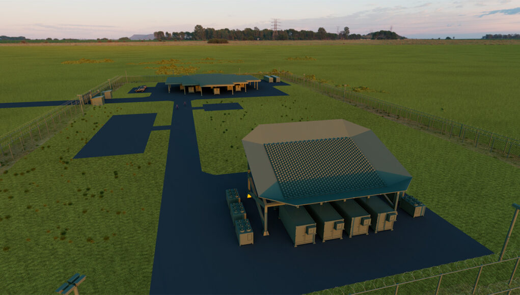
Thales has announced a contract from France’s Defence Procurement Agency (DGA) to develop and deploy a new ground-based radar system designed to track satellites and debris in low Earth orbit, the company stated.
The radar, named AURORE, is part of France’s ARES programme (Action and Space Resilience) and will provide real-time surveillance of multiple objects in space simultaneously.
Thales said AURORE will be the largest and most advanced space surveillance radar system in Europe and will enhance France’s capacity to monitor and assess the space environment amid growing military competition in orbit.
Developed and built at Thales’ site in Limours, the radar will draw on the company’s experience in air and space surveillance and benefit from contributions by several French small and medium-sized enterprises.
The system is software defined and operates in the ultra high frequency (UHF) band, providing continuous monitoring, high responsiveness, and high-resolution imagery of low Earth orbit.
Thales described AURORE as modular and adaptable, serving as the foundation for a new generation of UHF radars that could also support ballistic missile defence and counter hypersonic applications.
“With AURORE, the only radar of its kind in Europe, Thales is contributing to French sovereignty by strengthening its capabilities for monitoring the space environment at low orbits,” said Patrice Caine, the company’s chairman and chief executive officer. “AURORE demonstrates, once again, Thales’ leadership in the field of air and space surveillance systems.”







Interesting that they describe this radar being capable of delivering high resolution images of object in low earth orbit. Must be using significant processing power to resolve UHF frequencies that can operate between 300Mhz to 1Ghz, as the wavelength is 1m to 30cm. Normally at these frequencies you get very fuzzy images, as the object gets painted by a large wave that can cover many items. So the returning wave has many multipath reflections. Making resolving into an image very difficult or should I say expensive. Its one of the reasons the US Missile Defence Agency, use a humongous X-band radar on the Sea Based X-band radar (SBX-1) platform. As it means the radar can “see” objects such a multiple independent re-entry vehicles (MIRVs) after they been deployed from the missile.
You get much better results with radars operating at a higher frequencies, as the wavelength is much shorter. Therefore the object being painted has less multipath returns to resolve. But the advantage of using UHF is that you don’t require a huge amount of transmitter power to reach a long distance. The radar used on the SBX-1 is monstrously powerful. You do not want to be standing in front of the radar when its transmitting! Wiki states the platform uses six caterpillar 3.6 MW (total 21.6MW) generators to power the platform and the radar. Enough for a small town.
Isn’t the SBX the one that sits on its own semi-submersible platform?
How on earth does it get high resolution images, when the radar face is so much bigger than the objects it is looking at?
Yes, the SBX I believe is based on an oil/gas exploration platform. I think it uses pod type thrusters for sailing, maneuvering and station keeping.
The radar is truly massive. It is based on the THAAD’s AN/APY-2. This is a X-band active electronically scanned array (AESA), which in itself is a very powerful radar. The SBX is nearly twice as large in surface area. Where the AN/APY-2 uses 25,000 transmit-receiver modules (TRMs). The SBX uses 45,000 TRMs. If we go by Wiki’s blurb. This radar has an instrumented range of 1200 miles (2000km).
The TRMs are arranged in an octagonal pattern. Which means when creating a boresight beam, so one coming tangentially from the centre of the array. There is more or less an even number of TRMs around the beam. This creates a fairly circular and narrow beam. The X-band using a wavelength of between 4cm down to 2.5cm. I’m not saying the beam will be this diameter, as at 1200 miles the beam will have divergence. But it may be less than 50cm in diameter at a focal point.
You will still get multi-path returns, but due to how small the wavelength is, it will be much easier for the signal processing to work out the actual shape of an object. As more of the object is painted by the beam. Whereas with the much longer wave UHF, parts of the beam may only return bits of the object. So the signal processing has to work much harder to put the shape together.
To put it another way it’s like putting together a jigsaw, where there’s no picture, but you’ve got the edges vs putting together an image from paper that has gone through a shredder.
Oh, you mean they can shape the beam like a lens to have it focus? That’s very cool, though it’s a bit like using a big handheld magnifying glass to look at a flea from hundreds of metres away.
Next question, how do you aim a beam 50cm wide onto a target about the same size 2000km away? Surely the timings and calculations involved would be stupendous.
There’s a number of ways for them to search low earth orbit, looking for objects. The first and perhaps easiest is to widen the AESA generated beam. As the beam is formed by mutually adding and subtracting individual beams. You can shape the beam from circular to a fan shape. This makes it easier to cover a large area of sky. If an object is detected, its track is recorded and then you use a narrower beam to identify it.
With AESA based radar, you have a second option. Which is to keep the beam narrow. Then sweep the sky fairly fast. Some point during the scan pattern it will find the object. But as the beam is already narrow. The return can be used to build up a picture of the target to find out what it is.
The timings and calculations for tracking an object say a thousand miles away is not easy. The maths is quite complex, but it’s been used for a number of decades, so is fairly well understood.
Traditional analogue radar requires very long durations between each pulse. As even though the pulse was traveling at the speed of light through its medium. It still takes time for the two way trip. If you transmitted to fast and the pulse hit something closer, the radar would have difficulty telling the objects apart. Today digital based radar can get around the issue by looking at the return signal in more detail. You can even give each pulse a separate id code. Making it easier to discriminate between each pulse.
The more complex part is the signal processing. As you have to sift through megabits or even terabits of data to form the image.
Don’t they have the NOSTRaDAMUS radar for that?
No, that’s a skywave radar that bounces off the upper atmosphere to look at aircraft a very long way away. This looks out into space.
This radar is part 1 of space warfare, within Ares: détection.
This radar is looking for any foreign satellites who may threat European interest in Space.
4 Space bases in France, with space command in Toulouse. The study of a space plane has been started, it is supposed to fly in 2027.
An alliance with Germany is aimed to extension early warning, to make a clear strike back to the right attacker. In a way, even if the force still remain in French hands, the inclusion of Germany in the French early warning chain says a lot in terms of shared trust.
You may add to the picture the GovSatCom initiative, a pooling of Space télécommunications satellites for government agencies, subscribed by half of the 27 membre states to this day. This constellation of geo stationary satellites provide a first secure and somewhat sovereign worldwide Network coverage. It shall be followed by Iris2.