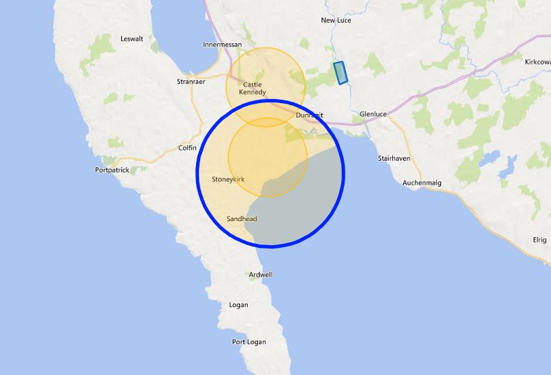
The Ministry of Defence (MOD) has issued a notification regarding an upcoming jamming trial at MOD West Freugh, scheduled to take place between 23rd September and 4th October 2024.
The trial will involve jamming of GNSS (Global Navigation Satellite System) signals and licence-exempt frequencies, affecting areas around Western Scotland, Northern Ireland, and the Isle of Man. The activity will occur daily from 0830 to 1730, as indicated by a Notice to Airmen (NOTAM).
The jamming will specifically target GNSS signals, including L1 and L2 bands, as well as various licence-exempt frequencies, such as 433MHz, 868MHz, 915MHz, 2400MHz, and 5800MHz. These jamming activities are expected to have the following impacts:
- At altitudes of 5,000 feet AMSL and below, the jamming is expected to affect areas up to 7 nautical miles (NM) from the jammer location, with the possibility of reaching up to 27 NM in rare cases.
- At altitudes between 10,000 and 40,000 feet AMSL, the jamming range is also expected to extend up to 7 NM but could reach as far as 49 NM in some instances.
- Licence-exempt frequencies could be jammed across a wider area, with disruptions possible up to 38 NM away at an altitude of 400 feet above ground level (AGL).
The jamming trial is expected to affect Remotely Piloted Aircraft Systems (RPAS) and electronic situational awareness devices operating within the specified areas and frequencies. Pilots and operators of RPAS are advised to take note of the potential for interference during this period and adjust their operations accordingly.
The jammers will be located within 3 miles of the coordinates 54°50′20″N 4°55′49″W, close to MOD West Freugh in southwest Scotland. This area is known for its use in defence trials and activities, including electronic warfare exercises.


A very interesting. little known site.
Good to see it is still used.
This will be cheaper than installing proper AD, but the problem will be collateral damage if this sort of EW system has to be activated around Faslane or Lossiemouth etc.
The Russians are having huge problems when “intercepted” Ukraine drone debris falls on their ammunition dumps at Toropets, in northwestern Russia. Tver and Tikhoretsk for example – The Toropets ammo explosion caused an earthquake measuring 2.7 on the Richter scale and apparently it is still burning three days later
A big kaboom mate. 😀
Whose system is being jammed?
Everyones by the look of it.
Happens a lot, always NOTAM’d. Not really news.
Well, why not let the news website decide what’s news, surely? Most people know know this happens often, surely it’s a good idea to inform them when it does so that they know?
Apologies, did not mean to cause offence. However as stated it is always publicised to those who may be affected. Primarily the aviation community where impact could be most serious. Google Map users probably are not top of their worry list.
Do not apologise, this is a media site after all, and we all know “media” churns out guff frequently.