

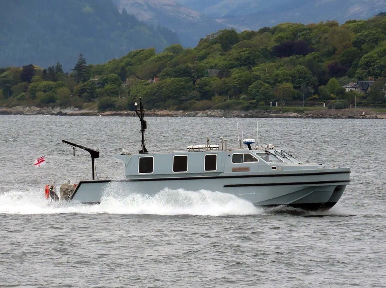
A specialist Royal Navy hydrographic team has been carrying out continuous seabed surveys in the Firth of Clyde since the spring, gathering data on water depth, seabed features and composition in support of operations, the Royal Navy stated.
The work is being conducted by Hydrographic eXploitation Group 3, part of the wider Hydrographic Exploitation Group based at HMNB Devonport. The team has been operating out of local towns and marinas around the Clyde, working from one of the group’s three 15-metre Vahana survey vessels and using specialist equipment to collect and analyse bathymetric data across designated survey areas.
According to the Royal Navy, the information gathered will feed into maintaining a comprehensive picture of the seabed and support future maritime activity. The Hydrographic Exploitation Group surveys waters ranging from shallow coastal areas out to deep ocean environments.
Alongside the data collection, the deployment has served as a training opportunity. Working in demanding conditions has allowed personnel to sustain and develop surveying skills, and the task has required the team to revisit techniques used less often in modern survey work, among them the establishment of geodetic base stations and the deployment of tidal monitoring equipment. The service says the deployment has tested both the equipment and the team’s ability to adapt to mission requirements.
The team has worked closely with the UK Hydrographic Office during the deployment, an arrangement the Royal Navy describes as allowing both organisations to share expertise and refine survey methodologies while contributing data supporting UK maritime operations.
Hydrographic survey has been a Royal Navy function for more than two centuries, with the Hydrographic Office established in 1795 and its charts subsequently adopted as a global standard. The service’s dedicated survey capability has contracted in recent years following the decommissioning of HMS Enterprise and HMS Echo, both of which left service in 2022 after two decades of survey and mine countermeasures support work.
The Hydrographic Exploitation Group was subsequently established as a Devonport-based organisation intended to deliver survey output through smaller craft and deployable teams rather than dedicated hydrographic ships, working alongside the Royal Navy’s wider survey, meteorological and oceanographic branch. Its Vahana-class boats can be moved by road and operated from harbours and marinas without requiring the support infrastructure a survey ship demands.



Id have thought it would have been done years ago
RN hydrographers have mapped the world. Assume features, obstacles may change and updates periodically needed, especially regards Submarine operations.
Sandbanks certainly, but rocks seldom move !! Perhaps they were looking for sneaky stuff placed on the Clyde approaches.
PC,
Sensors or mines? Either or both should properly arise the competitive spirit of the RN, one would hope.
… arouse… 🙄
Got hope that this is a routine renewal of data for a significant waterway. Baseline data would hopefully already be available but how wide an area is covered, and how often, is the bigger question possibly.
It has been done multiple times over the last 6 decades ever since the RN and USN based SSBNs in the Clyde. Which is why it’s such a good place to train as you have a known baseline to measure success against.
And it’s also a really good idea to ensure there are no new rock like little packages down there that have magically appeared since the last survey.
After all it is pretty well known that the USN and RN got up to all sorts of little tricks near Soviet bases during the Cold War.
ABCR,
Orcs are a definite issue, but just imagine when the ChiComs become adventurous. 🤔😱😉
You never know what you will find at the bottom of the sea. During dredging operations in Portsmouth to make way for the new aircraft carriers, all sorts of items were found. These included an aircraft engine and a human skull (passed to the police for further investigation).