HMS Enterprise ventured closer to the North Pole than any other Royal Navy vessel in 2022, sailing within 1,000 miles of the top of the world.
The Royal Navy say here that the survey ship headed into the Arctic to update charts and scientific understanding of waters increasingly patrolled by Royal Navy warships to maintain freedom of navigation of the High North.
“After receiving specific training for the mission – which saw crew facing water and air temperatures just above freezing, even at the beginning of autumn – Enterprise made for the Barents Sea off the northern coast of Norway. Passing 66.56° North crew painted the bull ring on the bow – known as a ‘blue nose’ – a traditional seafaring ceremony to designate a ship has sailed inside the Arctic
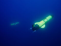
Using an array of equipment including single and multi-beam echo sounders, towed sensors and remotely operated bodies to gather hydrographic and oceanographic data, which will benefit scientists, fellow seafarers and Royal Navy operations. The ship spent two months collecting information, pausing to cast a wreath into Arctic waters in tribute to all those sailors who ran the Nazi gauntlet and braved horrendous conditions to deliver supplies to the Soviet Union on convoy runs between 1941 and 1945.”
Following a short stop in the Norwegian city of Tromsø to change crew and take on supplies, sailors tackled various adventurous activities: mountain climbing, running 15 miles around the island on which the port sits, and even braving taking a dip in the Arctic waters.
You can read more here.





Any “Navy” commentators on here with experience of Hydrographic survey ?
I would be interested to know do they provide all “data”gathered to other seafarers and scientists, or is some held back purely for military purposes.
I would guess that most of it is relevant for submarine operations, both SSBN and SSN.
What they gather isn’t ‘secret stuff’, mainly environmental data and bottom profiling/seabed composition. This has uses both for the military and civilians. It finds its way into the wider seafaring Community via the UKHO sales.
It is another area where we are world leaders in. Approximately oy about 20% of the world’s oceans/seas are believed to have had a upto date survey within the last 15-20 years!! Lots of work for those who want it, which is why it’s a crime for UK PLC to cut this vital capability. It feeds directly into SM/ASW ops and more.
The fact it generates income as well as valuable information should see it maintained. Even using other budgets to part fund new assets would be useful. Then the supply of new vessels needed feeds into the ship building strategy. Then all the useful kit they use that’s made in the U.K. also keeps businesses running.
They vessels could even be sold half way through service to nations needing patrol boats.
No idea what income is generated via sale of data, but just updating charts for seafarers brings in large sums.
It’s probably not far off revenue neutral for operating costs if truth be told, as you say we need the data so keep the ships coming with specialist crews.
Feasible to designate more and less sensitive areas for release of updated info? By all means, continue mapping but be judicious about release of info. Hate to think about Mad Vlad”s Orcs and ChiComs benefiting from this.
Unfortunately and I hate to admit it, but Mad Vlad’s Orcs are non to shabby in this area either. In fact I would hazard a guess and say that in some areas they are probably better, certainly been at the non acoustic environmental game far longer than we have and have poured substantial sums into this area. It’s just fortunate that they don’t have that many SMs to exploit there knowhow with.
☹️
The Navy’s Hydrograhic branch have been issuing sea farers top of the range Navigation charts for years most of the world’s Seas and oceans have been surveyed by the Branch such as changes in Ocean current and temp these data is shared with the scientific community Route surveys around the UK were carried out by MCM vessels as well as the hydro ships a lot of that data was mainly for the MOD “undersea cables of National importance along with discarded ordinance, dealt with by MCMs Amy new or uncharted wreaks though that would be shared
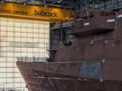
Seems strange that the Navy is seeking a secondhand vessel to provide the initial Mross capability, while Enterprise’s sister, Echo, sits up a creek somewhere.
It’s a certification thing. I guess as they were built to commercial standards. It’s better to take a vessel from trade with ROV and bigger crane capacity to carry out the MROSS role I’d imagine
Echo is a relatively tiny ship.
The MROSS is much bigger ship with a higher crane capacity etc.
Even if Echo could do the job, it’s currently up a creek because running three ships is too expensive. I assume before the two MROSS ships become operational, Enterprise and Scott will also have to go.
Not so much running the ships but the crews need to be made available if they are going to take on a new bigger vessel and manpower is at critical levels as the many of the youth of today just don’t want to do a real job. We ran a larger survey fleet in the past but Tech has helped reduce this need but still need manpower to man them. Yes they contribute to the UK Plc income through sales of course. A true asset for the UK both for MOD and wider civilian world using the seas.
Great ships however as things like sonars become increasingly modular and off board specialist vessels have less utility verses a COTS solution. Detailed hydrographic surveys are massively important for a host if industries and they have developed cheap effective tech for it.
Interesting they are flying crews on an off as well. I firmly believe this is the way the navy needs to go more and more just like commercial operations would do. Rotating crews on a 28 day schedule rather than sending people off for 6 months or more at a time.
That’s easy when its but a few but not practical when your want to change over 200 sailors. The forward deployment of units for several years and change over like we do with the ships in the Gulf (nothing new actually as the RN did that in the past) but it works as long as you use the same class crews (they screwed it up with T42’s as a stumpy and stretched have vastly different crew numbers and some one in Navy Cmd could not count so well). Lets see what the T31/32’s show up with and of course the MCM teams still could do with a few actual support vessels that can take all that modern high tech as air and road is not always the best way.
How dare they do this? Do they not know that Czar Putin claims all he surveys? The artic belongs to Russia and also somehow the Chinese are also allowed to transit and claim large access rights to the area as well.- which beats me as they most definitely are not an artic country.
Ha, yes- they’ve declared themselves a ‘near arctic’ state- as is every other state in the northern hemisphere…
Either Echo or Enterprise visited Durban in the early 2000’s. We paddled up to her on our K2(double kayak) and had a chat with a friendly sailor manning the bow watch who wouldn’t give us any information in response to our queries about their mission in the best traditions of the RN. The local 9mm auto armed harbour police quickly escorted us away from the vicinity.
Daniele has heard this story a few times😅
Indeed my friend.
..but did you hear the one about the time we were charged by a Black Rhino in Umfolozi? If not I will save that for the week before Christmas when George’s Reindeer are being tracked by the RAF!😉
I don’t remember it! Christmas stories with geoff it is.
Good! They are welcome in the Canadian arctic. Lots of real estate there to still survey.
Those subs we sold you, one, careful, previous owner, which (nearly) went… down… so we’ll, here’s the deal my friend couple of little skimmers suited to just your needs, give us a pony and deal it is, owns your father, Bob’s yer uncle 😉
Well the survey’s carried out by Franklin and McClure are still not complete so I think we will PO you or call it even 😉
HMS Enterprise did use her survey equipment in the Norwegian Sea and the Denmark Strait with a service of remembrance over the wreck of HMS Hood