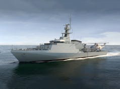
Royal Navy vessel HMS Magpie has tested software to map the seabed in hours rather than days or weeks.
The Royal Navy say here that HMS Magpie was able to chart the waters around Plymouth purely using regular radar installed on shipping the world over and a specialist computer program which measures wave height.
“Using that data and information about currents, the software can produce a detailed profile of the seabed in a matter of hours – without the ship or boat having to physically sail over the area being surveyed.All the system needs is wind and a swell to generate waves – plus computing power. It is not as detailed as the scans Magpie or other Royal Navy survey vessels can produce with their hi-tech sonar suites – and it only works close to shore.
But the method – known as radar bathymetry and developed by scientists from the National Oceanography Centre in Liverpool and MOD experts from Defence Science and Technology Laboratory – could be vital in times of peace or war when time is critical.”

Lead project scientist at the National Oceanography Centre, Paul Bell, said:
“By analysing the sea clutter images of waves visible on standard marine radars a bathymetric profile (that’s the depth) and surface current assessment is created. This technique could allow the remote charting of both shallow water and currents from a standoff distance of several nautical miles and could be employed by all Royal Navy Ships using the navigation radars that are already fitted with.”





This is incredible technology and a fantastic achievement.
I am certain that the resolution is not comparable to multibeam but it could have so many uses. There are many, many areas of the world that have not been surveyed with anything more than a lead line.
Just an afterthought but I wonder if it has any potential for shallow water ASW.
Yes, it would do.
It isn’t a new idea in that realm.
The issue being it only works in very shallow water when there is decent wave action and currents to be disturbed.
As a tech for guarding harbour approaches it would certainly be useful.
Cheers ?. I had no idea about that. I imagine the computing power required is significant but if Magpie can do it.
Sounds incredible however with so many variables That could throw up a spanner I’m not sure I would look to risk my vessel/crew on the telemetry.
With this also being limited to coastal zones it would surely be only of use to the MOD for a beach assault?
You make a good point but in many parts of the world the choice may be risk your vessel with this data or risk it with a chart using data from 1905. Considering this is just software it is incredible. I am very impressed.
Astonishing tech. It makes my days of farting around with Klein sidescan sonars and Atlas echo-sounders seem positively antediluvian (literally)!
Just in case anyone missed this. Here’s natural imaging for you!
‘Hovering ship’ photographed off Cornish coast by walker – BBC News
Wow!
I head they can track the wake of a sub via laser scanning also, but this is really neat.
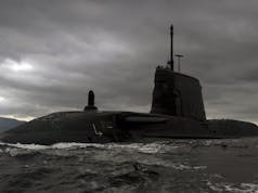
Have a close look at the latest images of the Trafalgar class boats, especially on the sides of the sail. There are sensors there that can measure the consistency of the passing water. They are using lasers for Spectrophotometry, which in turn measure what molecules are in the water. They could determine certain paint flakes, parts of an anechoic tile or if the water is warmer than the surrounding area. This data can then be used to speculate a sub had passed through the waters. The Russians have been using it for years and we have been playing catch up. But its another method besides sonar to search for a sub.
Little bit more to it than that.
Laser spectroscopy will have a role and as you say pick up paint flakes and liquid/gaseous outputs.
Sampled MS (mass spectroscopy) techniques will gives loads more information such as isotope ratios being distorted.
Isotope ratios are valuable as they can fingerprint the cooling water from a reactor type based on the differentials from the known local ratios etc.
Temperature differentials wouldn’t require anything more than a series of indiscernible Pt probes.
Give me the data and I will give you the world. Deep learning AI turns all sensors -even the most mundane – into data collection platforms to feed algorithms with Big Data that can make suprising insights. The future.