Lockheed Martin has been contracted to undertake navigation subsystem development efforts for the American Columbia class and British Dreadnought class nuclear-armed submarines.
According to a contract notice:
“The Lockheed Martin Corp., Rotary and Mission Systems, Mitchell Field, New York, is awarded a $29,781,688 cost-plus-incentive-fee and cost-plus-fixed-fee contract modification (P00039) to a previously awarded and announced contract (N00030-20-C-0045) for the United States and United Kingdom to provide Strategic Weapon System Trident Fleet Support, Trident II SSP Shipboard Integration (SSI) Increment 8, SSI Increment 16, Columbia-class and U.K. Dreadnought-class navigation subsystem development efforts.
Work will be performed in Mitchel Field, New York (47%); Huntington Beach, California (36%); Clearwater, Florida (9%); Cambridge, Massachusetts (6%); and Hingham, Massachusetts (2%) with an expected completion date of November 30, 2023. Fiscal 2022 other procurement (Navy) funds in the amount of $23,629,506, are anticipated to be available and fully funded via contract modification. Fiscal 2022 operation and maintenance (Navy) funds in the amount of $4,992,600 and Fiscal 2022 shipbuilding and conversion funds in the amount of $1,159,582 are subject to availability of funds via contract modification. No funds will expire at the end of the current fiscal year.
This contract was a sole-source acquisition in accordance with 10 U.S. Code 2304(c)(1) and (4). Strategic Systems Programs, Washington, D.C., is the contracting activity.”
The contract is valued at $29.8m.


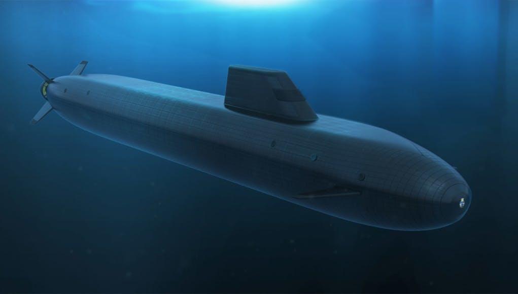


Is it just me or does it feel like the Dreadnaught will be a shorter Columbia class sub with a different skin? I’m sure it helps keep the cost down but it feels like we are getting less than 10% of the work share if we make up 20% of the joint procurement.
Pretty sure Laser Ring Gradiometer’s are not classified still as I am talking late 80’s early 1990’s , so always wondered what treasures were behind the Masscons used as known way-points. Sometimes fantasized rather than tons of Nickel that what was sliding underneath that it was GOLD . Hundreds of kilometres beyond the reach of any possible man within the mantle just teasing us on what real wealth is .
Totally lost me Real Sean I wS a Surface Skimmer not a Sundodger
Whatever language that was I wish I had a passing familiarity with it, I feel like I’m missing out on something deep and important. And I could do with some Gold, though in an emergency platinum or silver will suffice.
Please could you ask the Real Sean what his post was about unless it has something too Precious metal trading I was just a Surface Sailor ,, Spyinthesky
masscons = Mass concentrations
Gradiometer = device for measuring localized variations in Earth’s gravitational field – often indicative of natural concentrations of mass/minerals/metals etc beneath the ground. Used for mineral prospecting. Known mass concentrations can be used as navigational waypoints. Gradiometers are useful in this role as they are passive sensors which do not emit anything detectable in order to operate.
Depending on the sensitivity of the gradiometer, mass concentrations “hundreds of kilometres beyond the reach…” means masscons at great depth beneath ground (or ocean floor in this case). i.e. could be seams of precious metals like gold.
Also Mantle means the Earth’s mantle which extends from ~ 10 km below the ocean floor and extends about 2500 km downwards towards Earth’s core. The Mantle occupies ~2/3 of the volume of Earth and is rich in minerals/metals etc.
Gradiometers can also measure local variations in Earth’s magnetic field which, again, can be induced by localized concentrations of metals.
Blimey, Gareth you could do a spot on Channel 4s Countdown and help Suzie Dent
Genuine question, how do submarines navigate accurately many metres below the surface? I assume that they are too deep to rely on satellite GPS signal. Is it traditional paper charts, compass bearing and dead reckoning?
Gyroscopes with the tiny drift corrected by cross referencing short range sonar scans of the seabed directly below with charts of the seafloor. Plotting speed and direction manually on paper charts like the traditional sea navigation method is done as a backup/error check. The short range sonar acts like a proximity sensor that allows them to see uncharted objects and the sea floor a few tens of meters away but is nearly undetectable by other submarines as it dissipates quickly. However as its looking down its not uncommon for the upper part of the submarine to hit neutrally buoyant debris… Read more »
Thanks. I’ve done a small bit of offshore navigation on pleasure craft, and was always curious about how submarines navigated without recourse to landmarks, buoyage, GPS, etc.
They use Ships Internal Navigation System (SINS) when they are dived. This positional data is fed into Wecdis – electronic charts, paper ones are used as a emergency facility should Wecdis fail. Every time a SM comes to PD to receive the broadcast, they update their position from GPS, this is then compared with the SINS position, allowing for drift within the system, then the SMs position is updated and they continue on their merry way.
Thanks. Amazing skills nonetheless. Must be very rewarding for a navigator to see his EP align very closely to the GPS position when compared. Even more impressive when operating in hostile waters around Russia/China etc, that may not be extensively charted by Western navies . Many of the Admiralty charts of the UK are based on soundings and surveys last carried out in the 19th century or before. Rocks may not move, but sandbanks and wrecks are variables.
There was a Dit (story) that whilst one of either the P class or O class subs was Navigating at night Red lights on a Navigation detour was made around a small Island when daylight Lamps were switched on the Island on the Chart was infact a coffee or tea droplet !!!!!!! Posse
Very Low frequency phased transmissions from Blighty. A bit like the “GEE” system used at night by the RAF when they wanted to bomb something smaller than a large city
No mate it’s not. See my reply to @PC above.
SMs use VLF to receive the broadcast on, by streaming a v long antennae wire behind them.
They still do refer to charts ( The Connecticut hit an seamount not noted on the chart available) . Now sensors are the newest tech.
This is something we can already do. Why are we paying for development instead of just having more Astute navigation systems?
Seems like it is for the missile part not the actual dead reckoning with accelerometers etc. or at least that is how I read it.
This is for the ‘Strategic Weapons System’ AKA Trident, not the subs.
The Dreadnought and Colombia class are being designed and built in lockstep. They will be very similar boats and share many subsystems. The trident tubes are built in the UK for both boats, other systems will be made in the US for both boats.
I think your find that this is an equipment update that runs along with the Trident missle system , Austute class are classed as Hunters the new Dreadnaughr class are the last resort Missle boats or For any Americans on this page Boomers but I’m just a surface (Skimmer) not a Sundodger
Whatever happened to supercavitating subs that were supposed to travel at hundreds of miles an hour and make everything else instantly obsolete?
They cant see where they are going and are extremely noisy, so apart from a Russian heavy torpedo no-ones used it.
they could not find a crew willing to blindly travel at a 1000kpm and die horribly after hitting some random island at supersonic speed.
At that speed I’d hate too be the one having too do Clock changes especially if your Zig Zaggi round the Atlantic
The Ruskies were working on and supposedly conducting trials on Supercavitating torpedoes an air votex bubble in front of the warhead could they have expanded the principle too the size of manned sub can’t see Putin not boosting about it if it was successful?
According to the usual Russian doom monger online (you know the hypersonic crew) according to them supercavitating torpedos have been around since the 60s with the Russians.
Must of been on watch when that came about, as only the other year not decades ago Mr Putin announced that they had developed a new Torpedo that was of a Supercavitating design that could travel at phenomenal speed , James anyway if WW 3 hasn’t broken out by Saturday have a happy New year 😀
Part 2 of my festive read spot:(note the photos will self delete by the 4th of Jan)
https://i.postimg.cc/pdTr8H30/img180.jpg
(note the photos will self delete by the 4th of Jan)
https://i.postimg.cc/RFJ0sTSK/img181.jpg
(The photos will self delete by the 4th of Jan)
https://i.postimg.cc/Fs4Kpc2k/img182.jpg
The photos will self delete by the 4th of Jan
https://i.postimg.cc/rwywXTy8/img183.jpg
So these boats are in build and until now they didn’t have a designated navigation system? How much more has yet to be designed and built?????
Tech is moving forward and as the in service date is still a very long way in the future, my guess is they will want to delay purchases of anything tech related to the last possible moment, based on when it needs to be fitted for the build.
I remember a couple of years ago, UCL announced they’d developed a working quantum compass concept for satellite independent submarine navigation. Wonder what came of it
ICL and M Squared. It was a one dimensional accelerometer and is commercially available, but you need to measure six degrees of freedom for navigation, three linear and three rotational. Watch this space (for about another decade).
https://www.imperial.ac.uk/news/188973/quantum-compass-could-allow-navigation-without/
This is an interesting read on quantum technology and submarines
800 new graduate and apprenticeship jobs at Barrow. Any chance a yard expansion is coming so UK can either build more Astutes and/ or a 2nd batch alongside th Dreadnought class. Maybe build for Australia or RN gets more new astutes built to free up a few for Aus?
Interesting announcement.