Henderson Island in the South Pacific is one mile south of the position marked on charts used by mariners the world over since 1937.
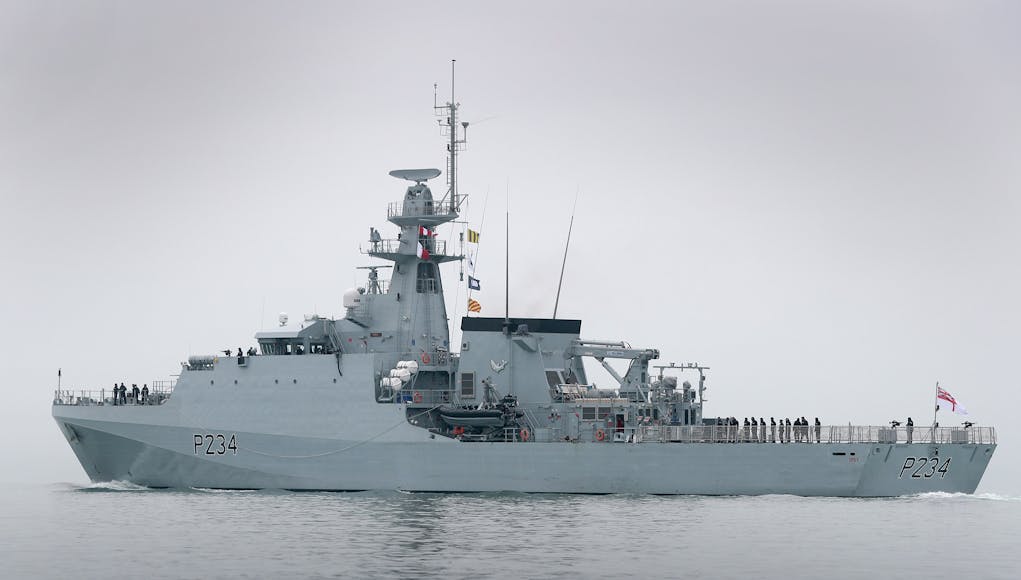
The Royal Navy say that patrol ship HMS Spey confirmed the error as part of efforts to check and update charts of waters around British Overseas Territories scattered around the globe.
“Uninhabited and about the size of Oxford, Henderson is one of four islands in the remote Pitcairn chain. Chile lies 3,600 miles to the east and New Zealand 3,200 miles to the southwest. The Royal Navy has been using navigational charts supplied by the UK Hydrographic Office, using the latest technology of the day, for more than 225 years.
Over the past 15 years, the majority of the Fleet has used digital charts. Key areas and seas regularly used are well covered by the electronic system which not only ensures pinpoint navigational accuracy, but allows sailors to ‘interrogate’ key features such as landmarks, buoys and depths, as well as turning specific features on/off as required.”
“In theory, the image returned by the radar should sit exactly over the charted feature – in this case, Henderson Island,” Lieutenant Royle explained.
“I found that wasn’t the case – the radar overlay was a mile away from the island, which means that the island was plotted in the incorrect position when the chart was first produced. The notes on the chart say that it was produced in 1937 from aerial photography, which implies that the aircraft which took the photos was slightly off in its navigational calculations.”









Assumed gps gave almost pinpoint accuracy these days, couldn’t really understand how they were determining exact position by radar. Can anyone explain.
GPS will tell them where the ship is, and their radar tells them where the island is relative to the ship. When they did that they noticed that the island was not where the map said it should be. Clearly no one has noticed before because it’s super remote and no one lives there so no one had actually checked.
We’ll presume due to GPS they know where they are and they have an overlay screen of radar return over a map. If the map says island is a mile away from where it is you radar return will show the overlay over open water hence wrong.
Cheers to you both for that.
This has examples of how it works https://www.maritime-executive.com/article/radar-overlay-to-improve-ecdis-navigation-2014-09-12
Given the distances from any major points of reference one mile is a negligible fraction. Really makes one appreciate how good the scientists of old were at their craft
Doesn’t it just, I marvel at such men.
My Cockef hat is off too them little Navigation joke there SpyintheSky
Henderson is by far the largest of the 4 Pitcairn group islands but has no pottable water. It also has a huge problem with plastic and when you consider how remote these islands are from other populated areas it illustrates just what a huge and underrated threat plastics are to the seas and planet at large. There are only about 50 residents on Pitcairn in what is going to be an extinct population in a few decades without some fresh migration. As with Tristan there is no airport so apart from the odd passing tourist and supply vessel, once you… Read more »
Yes considering the stick they got it’s good to see them doing very valuable work. Seem to be getting a lot of praise these days.
Indeed Spy-takes a lot of pressure off the front line assets
It is a weird place. In 2004 two-thirds of the men on the island, from a total population of fewer than 40 went on trial for sexual assault. A jail was built on the island which the police lady slept in as she felt safer in it. None of the convicted spent a night in the jail.
For that reason, I doubt there will be any fresh immigration – most of the movement is the other way…..
The next visit by an RN ship after the last resident dies/leaves will probably find it fully occupied by Chinese and a casino built 😉
Haha. It would make operation corporate to retake the Falklands look easy compared to getting the fleet to pitcairns.
The islanders have there own customs etc as they were cut off for so long. I think the sexual assault issue was a strange one. Goodness knows what they are up to.
I wish them well and still admire how they have managed to live on this small island in the middle of the ocean.
Just to add this is a great role for the river class. Imagine sending a frigate or destroyer now to check on them.
I had thought that the carrier would do a circle of the globe passing Australia, New Zealand and onto the other pacific islands the U.K. has past in. Then onto falklands and back up the Atlantic. Maybe one day
A Type 23 was there a couple of years ago. Better to send a River in case of mutiny and not have such a valuable asset as a Type 23/45 scuttled in the harbor. That is my guess anyway.
Haha Ron. You reckon the propensity to mutiny is still in the blood of Fletcher Christians relatives😂
I believe that Henderson Island was destination (or a waypoint) of Amelia Earhart’s flight.
Yeah Noonan wouldn’t have known his maps were faulty
I think they were shooting for Howland Island, not Henderson. Much further west.
Well… time to throw out all my map books.
Oops. Sorry folks.